Categories
Portuguese Colonialism Zimbabwe

Maramuca: Portuguese Settlement, Market (Feira) in Zimbabwe

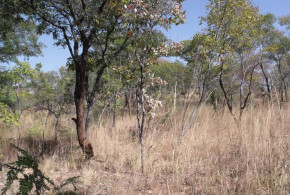
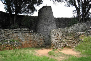
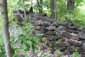
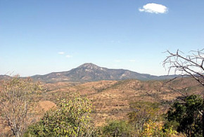
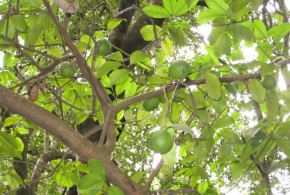
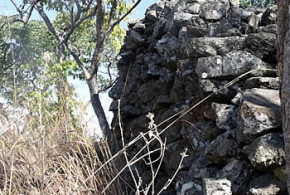
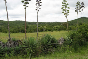
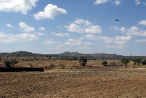
Written by Chris Dunbar. All pictures are copyright by Chris Dunbar.

Maramuca, 2010:

The trip to Maramuca was via the town of Chegutu and then another 30 odd kilometres on an old strip road to the gold mining town of Chakari. From Chakari we had to travel on a dirt road which later turned into a dirt track.

The location of this site is on an old bend on the Suri Suri River, it is possible but not likely that this section of the river formed part of an ox bow during the years that the Portuguese settled this feira.

Once we were in the vicinity of the Suri Suri River gold panning by illegal miners became very evident, holes dug by the miners became an increasing worry for me as I did not want to over turn the Land Cruiser that I was driving.

We parked the vehicle and decided to walk to the site of Maramuca, the bush was extremely thick with grass and very wooded, which was strange as I would have thought that the miners would have removed the trees for fire wood.

At each active illegal gold mine I was offered gold dust, us$2.00 per point and a point was about one gram. A fantastic price but as it is illegal I would not purchase the gold dust.

We walked for close to five kilometres to locate the site in extremely hot temperatures. The amount of gold dust offered to me brought back the fact that the Portuguese traders at the feira must have has access to a considerable amount of gold.

The feira itself once found was in a very sorry state and the walls which were hardly visible in the 1960’s were completely gone, the illegal miners had completely destroyed the site. Without the use of a GPS I would have not found this site.

We know that a Portuguese trader Goncalvo Joao had secured the rights to trade in this area and that he probably built the walls and the feira. In the 1930’s an ivory statuette depicting Our Lady of the Immaculate Conception was found in the ancient gold workings, modern day Bay Horse Mine, it is I am told at the Bulawayo Museum.

I was able to collect some Blue on White Chinese Ceramic shards and number of arrow and spear heads all were collected, position located via the GPS and returned to the National Museums and Monuments inspector that accompanied me.

[divider]

[divider]

Maramuca, 2012:

These pictures are taken about 300 metres south of where I found the porcelain in 2010. We still did not positively identify the site but can be sure of the ancient workings that Garlake mentioned “and a similar kopje 100 yards (91 m’s) to the north is pitted with shallow ancient workings.”

So I have attached two pictures one of these shallow ancient workings and one from these workings looking towards the feira site. The other is of an ant hill which we think is the ant hill that has consumed the brick buildings in the site, see the site plan which is also attached.

No positive identification, however. The damage from the gold panners is great but no pottery etc was found as positive identification.

[divider]

[divider]

Categories
Portuguese Colonialism Zimbabwe

Great Zimbabwe: a ruined city in the southeastern hills of Zimbabwe

Written by Marco Ramerini. Photos copyright by Chris Dunbar.

Great Zimbabwe was the capital of the Kingdom of Zimbabwe where was the royal palace and the seat of the political power. The city was surrounded by massive walls that reach 5 meters in height which were constructed without mortar.

The area where is Great Zimbabwe was occupied from the fourth century AD but the real city, whose ruins you can see today was built between 1.100 to 1.450 AD, in times of greatest glory, Great Zimbabwe, was to be inhabited by about 18,000 inhabitants and covers an area of 722 hectares.

Starting in 1300 due to the decline of trade and probably also for climate change that led to water shortages, the city was gradually abandoned, and fell into ruin. The first Europeans who visited the town were Portuguese merchants and soldiers in the early sixteenth century. In 1511 the site of Great Zimbabwe was visited by the Portuguese explorer António Fernandes.

Several Portuguese testimonials described the city, among them that of Vicente Pegado, captain of the fortress of Sofala, reported by João de Barros. This testimony shows the first description of the city as seen from the eyes of Europeans. The Portuguese who had settled at Sofala from the beginning of the 16th century frequented the area of Great Zimbabwe where were numerous gold mines.

Great Zimbabwe has been a UNESCO World Heritage Site since 1986.

[divider]

[divider]

BIBLIOGRAPHY:

– Various Authors, “A Guide to the Great Zimbabwe Ruins” National Museums, 1976.

– Bessire, Mark “Great Zimbabwe” Franklin Watts, 1999

– Garlake, Peter “Great Zimbabwe (New Aspects of Archaeology)” Stein & Day Pub, 1973.

– Garlake, P. S. ” Seventeenth century Portuguese earthworks in Rhodesia” In: “South African Arch. Bull.” n° 84, 1966, pp. 157-170

– Garlake, Peter “Great Zimbabwe Described and Explained” Zimbabwe Publishing House, Harare, 1985.

– Mallows, Wilfrid “Mystery of the Great Zimbabwe The Key to a Major Archaeological Enigma” Robert Hale Ltd, London, 1985.

– Newitt, M.D.D. “Portuguese settlement on the Zambese: Exploration, Land Tenure & Colonial Rule in East Africa” 434 pp. Maps, illus.& plates. Longmans, 1973, London, UK.

– Rea Francis, W. “The economics of the Zambezi missions, 1580-1759” 189 pp. Institutum Historicum S. I., 1976, Roma, Italia.

Categories
Portuguese Colonialism Zimbabwe

Portuguese Forts, Markets (Feira) and Settlements in Zimbabwe

Written by Chris Dunbar

The following is a list of sites that were investigated by the Rhodesian / Zimbabwean Government, no suspected Portuguese sites have been restored (unfortunately) and no more have been added since the first cataloguing was done in the early 1970’s. A number of the historical trading centres and forts have still not been located and further investigation is required in this area. So as follows the site name and the Departments internal National Monuments identification.

PIRINGANI (The Lemon Forest)(Piringani: 16°59′ 48.63″S 30°11′ 27.97″E): Pirigani 1630 CC 5

MASSAPA: (Massapa covers about 4 square km’s and is centred at 16°48′ 08.35″S 31°39′ 01.80″E) Chesa Farm 1631 DC 34 Guzha Farm 1631 DC 38 Guzha Farm 1631 DC 39 Murewa farm 1631 DC 40 Chemapere 1631 DC 41 Bhasikiti 1631 DC 42 Kapfira 1631 DC 43 Mandishora Farm 1631 DC 46

Undetermined require more data: Umfurudzi 1631 DD 17 Umfurudzi 1631 DD 18 Chipunza 1631 DD 19 Muchekayawa 1631 DD 20 Chiweshe 1631 DD 21 Chikohora 1631 DD 22 Zvipfuko 1631 DD 23

ANGWA (ONGOE): Angwa Fort 3 1729 BB 1 Angwa Fort 1 1729 BB 2 Angwa Fort 4 1729 BB 3 Angwa Fort 5 1729 BB 4 Angwa Fort 2 1729 BB 5 Two Tree Hill Estate 1729 BB 19

DAMBARARE: (Dambarare covers about 6 square km’s) Dambarare – Doxford 1730 BD 2 Flowing Bowl Mine 1730 BD 4 Dambarare 1730 BD 18 Dambarare 1730 BD 19 Dambarare 1730 BD 20 Dambarare 1730 BD 21 Dambarare 1730 BD 22 Dambarare 1730 BD 23 Doxford 1730 BD 27 Doxford 1730 BD 32 Pentland Farm 1730 BD 33

Quitamboruidzi

LUANZE: Luanze 1732 BA 1

Makaha 1732 BC 1

Maramuca 1829 BB 2

Shigodora (Chipangura) 1932 BA 19

Bocuto un-located suspected to be in the Umfurudzi Wilderness Area

Vumba this site has not been located

Matafuna suspected to be in the Shamva region

Matuka suspected to be in the Odzi region

Urupanda this site has not been located

BIBLIOGRAPHY:

– Various Authors “Documentos sobre os portugueses em Moçambique e na Africa central, 1497-1840. Documents on the Portuguese in Mozambique and Central Africa, 1497-1840” National Archives of Rhodesia and Nyasaland, Centro de Estudos Históricos Ultramarinos, 1962-(1989), Lisboa. Includes indexes. “The sources have been drawn from archives and libraries in Portugal, Italy, France and other countries … Published in the original with an English translation. Contents: v. 1. 1497-1506.–v. 2. 1507-1510.–v. 3. 1511-1514.–v. 4. 1515-1516.–v. 5. 1517-1518.–v. 6. 1519-1537.–v. 7. 1540-1560.–v. 8. 1561-1588.–v. 9. 1589-1615.

– Axelson, Eric “Portuguese settlement in the interior of South-East Africa in the seventeenth century” 17, [1] p. ; Sep. Actas Congresso Internacional História dos Descobrimentos, 5, 1961, Lisboa.

– Axelson, Eric “Portuguese in South-East Africa, 1488-1600” 276 pp. Struik, 1973, Cape Town, S.A.

– Axelson, Eric “Portuguese in South-East Africa, 1600-1700” x + 226 pp. Witwatersrand University Press, 1969, Johannesburg, S.A.

– Ferreira, A. Rita “African kingdoms and alien settlements in Central Mozambique (c. 15th-17th Cent.)” 172 pp. Departamento de antropologia, Universidade de Coimbra, 1999, Coimbra, Portugal.

– Garlake, P. S. ” Seventeenth century Portuguese earthworks in Rhodesia” In: “South African Arch. Bull.” n° 84, 1966, pp. 157-170

– Newitt, M.D.D. “Portuguese settlement on the Zambese: Exploration, Land Tenure & Colonial Rule in East Africa” 434 pp. Maps, illus.& plates. Longmans, 1973, London, UK.

– Newitt, Malyn D.D. “A History of Mozambique” 679 pp. maps Hurst and Company, 1995, London, UK.

– Newitt, M.D.D. “The Portuguese on the Zambesi from the Seventeenth to the Nineteenth Centuries” In: “An expanding world” vol. n° 25 “Settlement patterns in early modern colonization, 16th-18th centuries” pp. 279-300 Ashgate Variorum, 1998 In: Race IX, n° 4, pp. 477-498 Institute of Race Relations, 1968, London,

– Newitt, M.D.D. “The Portuguese on the Zambesi: an historical interpretation of the Prazo system” In: “An Expanding World” Vol. n° 4; Disney, A. “Historiorgraphy of Europeans in Africa and Asia 1450-1800” Ashgate Variorum, vol. n° 4, 1995; pp. 155-173 Also in: “Journal of African History” vol.10, n°1, 1969, Cambridge, pp. 67-85

– Rea Francis, W. “The economics of the Zambezi missions, 1580-1759” 189 pp. Institutum Historicum S. I., 1976, Roma, Italia.

– Strandes, J. “The Portuguese period in East Africa” xii, 325 pp., 5 plates, folding map, Edited by J. S. Kirkman, 1968, Nairobi, Kenya.

Categories
Portuguese Colonialism Zimbabwe

Massapa: Portuguese Settlement, Market (Feira) and Fort in Zimbabwe

Written by Chris Dunbar. All pictures are copyright by Chris Dunbar.

Massapa was described in 1573 as being close to the wooded mountain Fura (Mt Darwin) had a Dominican Church dedicated to the Lady of the Rosary and was deserted in 1693 when the Rozvi went on the rampage that ended the Portuguese control on the whole Northern Zimbabwe plateau and is now simply the ploughed lands know as Baranda farm and Chesa farm 4.

The modern owners of these small communial farms were very helpful and assisted us with searching for the remains of the settlements. The owner of Baranda Farm confirmed that the well that his family still uses was there when his father arrived in the area and we know that prior to that it was an uninhabited land so the well could very well date back to the more fruitful times of Massapa.

Here a number of pictures, nothing really to see as the plough has leveled the forts over the many years but the hot, harsh environment is evident. Under these fields lay the remains of many great adventurers awaiting the time when their stories can be told in full.

[divider]

[divider]

Here are some pictures of the “native” dry stone walled fort. This National Monument has been severly destroyed by illegal gold panners and a great lose to history.

This dry stone walled fort is our best guess as to where the Captain of the Gates resided. He would have been a Portuguese soldier and a man of great influence and would have been appointed to this position by the Viceroy in India. He would have had control over all Portuguese traders who traveled through this area. It has direct line of sight to Mount Fura (Mt Darwin) where the historical Monomotapa Gatsi Rusere is buried. This grave is now a shrine to many people in this area. I was allowed access but ran out of time to undertake the climb to this grave site.

Nyambo Kapararidze the new Paramount Chief killed Pereira’s ambassador Jeronimo de Barros on the 17th November 1628. The Captain of the Gates, who was at Zimbabwe at the time, having presumably escorted the ambassador there, defended himself until nightfall. He escaped in a heavy rainstorm in the darkness, and reached Massapa (the distance from this stone walled fort to Massapa, now Barranda Farm, was about thre km’s straight line). This incident either took place in the fort pictured or from the dry stone walled on Mt Fura itself.

[divider]

[divider]

Categories
Portuguese Colonialism Zimbabwe

Piringani: Portuguese Settlement, Market (Feira) in Zimbabwe

Written by Chris Dunbar. All pictures are copyright by Chris Dunbar.

So to Piringani (Piringani: 16°59′ 48.63″S 30°11′ 27.97″E), in the north west of Zimbabwe, in the farm lands of Doma, I went. Rumour had it that there was a Lemon forest and that it was marked and known by the local farmers and the Department of National Monuments.

I could not find any rock / stone or mud ruins at this site but did find the lemon forest. The trees have self propagated from the original stock, which is believed to have been planted by the Portuguese Friars. The Lemons were planted to assist with the health and well being of the settlers at this settlement.

I am told by the locals along the Angwa River (which is about twenty Km’s from Piringani) that the forts at Angwa are down to the foundations and no walls are left standing, but that the Lemon Forests along the Angwa are very spectacular and hold many more trees then at the Piringani Site.

I was at the Angwa (Angoe) but was not able to get to the sites, the lemon forest at Piringani / Ditchwe site is a little south east of those forts.

At last a picture of Wild date Palms, germinated from seeds probably spat out by Portuguese explorers. GPS 17 2.001’s and 30 4.576’e this is located half way between the Piringani Lemon forst and the Angwa river forts.

Categories
Portuguese Colonialism Zimbabwe

Ruanga: a native settlement in Zimbabwe

Written by Chris Dunbar. All pictures are copyright by Chris Dunbar.

Ruanga, 2012:

Some pictures from Ruanga a settlement that was excavated in the 1960’s and it was found to have been inhabited in the 1500’s to the end of the 1650’s.

Native black africans, but what is interesting is that perhaps, according to Hugh Tracey assumption, Antonio Fernades visited this settlement in May/June of 1514. *1)

It is found in the Umfurudzi Park in Northern Zimbabwe, it has been very much overgrown but we hope one day that it will be cleaned up and preserved.

*1) In 1968 (Hugh Tracey “Antonio Fernades: Rhodesia’s first pioneer” pages 1-26 Rhodesiana n°19 December 1968) the historian Hugh Tracey tried to retrace on paper the routes or routes taken by Antonio Fernades (AF) when he penetrated into the now Zimbabwe Plateau.

We know that he made the two trips, the first trip can be dated pretty accurately as the Second Viceroy of India wrote to the King of Portugal from Goa on the 25th of October 1514 writing about the degredado who was sent to discover the lands of Monomutapa. It would have taken two months for a ship to have gone from Sofala to Goa, so news would have left Sofala perhaps late July 1514. Gasper Veloso the Sofala fort clerk, wrote down the Antonio Fernades account of this journey into the lands of the Monomutapa.

One part of the article discusses Antonio Fernades going to Embire, which is a fortress of the King of Monomutapa which “he is now making of stone without mortar” which is called Camanhaya. It is a journey of five days.

Hugh Tracey argues that this relates to: Antonio Fernades proceeded from Tafuna / Matafuna to the court of Embiri / Mbiri this village of Monomutapa was a fortress called Gamahaya (Kamangaia, or Kwa Manyaia) “which he is now building of stone without mortar”. We know of a few stone fortresses in the district. Fura or Mt Darwin is only two or three days journey from the Mazowe River to Tafuna / Matafuna. On Tungagore between the Mutua and Ruiana Streams is a fortress this is about five days from Tafuna / Matafuna but is fifteen miles east of where the site of Monomutapa’s kraal was believed to be.

Tracey goes on to state “should there prove to be a stone fortress upon the hill Runga (his spelling) it would entirely agree with Antonio Fernades’s five day journey from the Mazowe and place the site of Monomutapa with some accuracy.

The ruins were found on Ruanga (what the locals call it now) and excavated by Garlake, habitation found from the early 1500’s to the mid 1600’s. The other loopholed forts in the area and one is close by are from the refuge period and dated to the late 1600’s. The visit of Antonio Fernades would be dated to about May / June 1514 due to the approximate time it took Antonio Fernades to get back to Sofala and for the ship to leave in July for Goa.

The distance from Tafuna Hill 17 .21.442’S and 31 .30.905’E and Ruanga Ruins 17 .1.307’S and 31 .45.579’E is about 47km’s.

[divider]

[divider]

Categories
Portuguese Colonialism Zimbabwe

Makaha: Portuguese Settlement, Market (Feira) in Zimbabwe

Written by Chris Dunbar. All pictures are copyright by Chris Dunbar.

The trip to find the site of Makaha was via the town of Mutoko and then on a dirt road for 90 minutes into the growth point of Makaha. Once we left the growth point we had to resort to four wheel driving as the road turned to a track and became very treacherous due the massive amount of illegal gold mining and the trenches and holes that the illegal miners had dug. Again as with my trip to find Maramuca I was offered gold dust at every illegal gold mine.

The location of this site is about five kilometres from the Ruenya River and while in the 1950’s the outer walls were still visible when I did find the site once again every thing had been obliterated by the illegal gold miners.

I discussed this particular site with a number of the staff from the Museums and with a number of interested parties, all agreed that this site was not actually Portuguese or at least there was very little evidence to show that it was settled by the Portuguese.

The excavations while only on a very minor scale failed to provide any further evidence of a Portuguese presence. The claim to it being Portuguese are based off a very old miners claim (1945) that he had found an earthwork similar to the ones on the Angwa River also documented in 1945.

In order for me to wonder around the bush near Makaha I had to gain permission from the local village elder and the local political commissioner and with their help I was taken to two very interesting sites, it was claimed that both sites were of Portuguese origin.

The first site was on top of a hill and was constructed of schist and was very clearly “native” I worked at the site for a number of hours and only found “native” pottery shards.

The second site was truly fantastic the walls and turrets were still standing, without the aid of cement. The outlines of the rooms were evident and the tree that was growing in the walls was at least 100 years but again I think it was too structured and when I looked on the map from the National Monuments I could not find any reference to it at all. I found no sign of Portuguese presence.

This site was north east of the Makaha site only about 2km’s. The walls are pretty much as is there were no scattered stones so the walls are close to their original height. The walls circled the top of the hill. The defensive line was probably 200 metres in circumference in the middle of the “fort” was a slight depression which I was told was were the white people of old (the village elder claimed Portuguese) had lived and to the left of that depression was a very deep shaft cut into the schist and that was a “gold” vein and the walls had been built to defend that “gold” vein. The entrance (there was only one) is clearly visible.

The elder claimed that this was a Portuguese site, to me it is clearly a stone “zimbabwe” I did not have the time to excavate, I did look at the construction and the surrounds, I was taken to number of large holes in the ground on the southern side of the hill about twenty metres below the summit and the walls and the holes were laid out in a definite pattern, the village elder said that these were graves. Now, when I sat with the village elder a few hours later and shared some water, he told me that he had only been in the area for 70 years, Makaha was well known to him as Portuguese, no Portuguese artefacts have been found and not even Blue on White Chinese Porcelain shards have been found. I think that over the years interested parties like me have come looking for the Portuguese site and he has heard the rumours and put them altogether in a jumbled story. The ruins on the hill, oral tradition states that these are Portuguese in origin. I would hazard that they were a defensive site to protect the local villages from the Portuguese.

What I did find interesting was a rumour that close to the supposed site of Makaha was a grave yard with headstones and inscriptions of Portuguese who had died in the area. I did not have time to follow this up but may make this a separate project for next year.

[divider]

[divider]

MAKAHA: EARLY SETTLERS HOUSE

Written by Chris Dunbar. All pictures are copyright by Chris Dunbar.

This one, I have called old settlers house. Truly I do not know who built it, I could not find it logged on the museums and monuments records.

To me after visiting Luanze, Angwa, and looking at the plans for Maramuca I just cannot bring myself to say that it is of Portuguese early origin. It is too structured and I have included pictures of the room layouts and of the “porch” layout. The walls were once very high, as can be seen using me as the height measurement.

The wall stones that have fallen are missing, not scattered so they have been carried away for another structure, I walked all over this hill and found no structures near by so they have been moved some distance away. There are a number of large trees in the house, and the type of tree suggests that they are at least 100 years old.

The village elder again claimed that this was Portuguese and he stated categorically that I was the first white man that he knew of that had visited it in all the time that he had been in the area (70 years). I was unable to excavate but after some grass clearing and surface searching I did not find anything at all to give me a datum. No pottery, no glass nothing.

The walls are made from local rock slabs not schist as per the other site, a completely different rock strata was in this area which was north east of the Makaha site 4 km’s and probably only 2 km’s from the other schist walled site. The stones are held in place with daga / mud, no cement or concrete at all. I imagined that there must have been timber trusses for the roof (no evidence found) the hill was well wooded but the type of trees growing are not the type to grown straight so maybe straight trunks were carted in.

This is the summary from the man who went looking for the Portuguese grave stones, in Makaha:

It is very sad to hear about the fate of the feiras and I suspect many other national monuments. I hope I may be able to explain the story of the headstones. It has been preserved, I suspect, by a paragraph in a Henk Ellert’s book, Rivers of Gold which quotes me saying I had heard of such things and spent some time looking for them, both of which are true. In the 1960s when I worked in the Honde Valley I was invited by a young Carmelite priest to do a tour of the north of the province which I had never been to. One night we stayed at Katere – I think the mission was called Regina Coeli – where the missionary was a tough but charming man called Senan Egan. He did a lot of prospecting and hunting apart from running a very successful mission-farm and said that across the river (Ruenya) he had found the gable end of a church and head stones with inscriptions, both of which he took to be Portuguese. He said tsetse officers had seen them in the same area. I resolved to go and have a look one day. Then the war happened. It was the 80s before I got back. I went with Chuck Bollong, the new archaeologist at QVM and my wife. I located Fr. Egan who gave us directions but was by now too old to come too. We spent a couple of days there but apart from meeting a lot of panners and a highly eccentric family of prospectors, all we found was some ruins of German mining endeavours from the early 20th century.

My next attempt was a couple of years later with Professor (Dave) Beach of UZ. This time we came in from the Mutoko side and hit the Makaha Feira straight away. In those days it was quite recognisable and even had a National Monuments sign on it. We spent another couple of days with the prospector but just found more of the German stuff. My conclusion after this was that what Fr Egan and the tsetse people had seen was early 20th century. This area was of course what Karl Mauch named the Kaiser Wilhelm gold field and there was a lot of early German interest. The prospector told us he had found an early Mercedes in the bush too but I am sceptical! So I think the feira is the only extant Portuguese site. What I saw was the remains of a strong point, square with star bastions on the corner. There was also a curtain wall at the entrance, but I suspect that was a later addition. There were some quite deep shafts near by.

The German miners settlement is at 1720’06.90″s and 3246’09.33″e on Google Earth, below that is the schist stone iron age settlement that I found also pictures on Google Earth and about five kilometres towards the big river (Ruenya) is the Feira of Makaha which I never found.

[divider]

[divider]

Categories
Portuguese Colonialism Zimbabwe

Luanze: Portuguese Settlement, Market (Feira) and Fort in Zimbabwe

Written by Chris Dunbar. All pictures are copyright by Chris Dunbar.

The Fort of Luanze, where the Portuguese hold a market, is in the lands of Mocaranga, forty leagues from Tete…..this fort has a church, served by a dominican friar who administrates the sacraments to the christians who dwell there or pass through. Pedro Barreto de Rezende, 1634.

I then went to Luanze which is about 450 km’s from the Piringani site and about 20 km’s short of the Mozambique border. I had with me a member of the Department of National Monuments as a guide and facilitator.

The remains of the houses built by the Portuguese traders are no longer visible but are indicated by a series of stone markers placed by the archaeologists that excavated the site in the 1960’s. The stone walls built by the local natives that co habited the site with the Portuguese traders are still very evident and the stream that started the trade in alluvial gold, was just evident. It was very difficult to picture the site as the vegetation has taken over but it was possible to walk along the walls that were built as barricades and protection. While in the trade square it was relatively (and surprising so) easy to pick up trade beads and shards of Chinese pottery that the Portuguese used to barter for gold and ivory.

Once you crossed the tar sealed road at the modern way stop (Masarakufa) it took a bit of looking to locate the site of the Dominican Church, but did find it as it is marked by a plinth placed by the Department of National Monuments. It is regrettably in a very poor state of repair, I had to clear some of the bush and grass as it was over my head, to find the foundations. The floor while once compacted and level is far from that today, the walls are only inches high but it is still possible to see the outline of the wooden poles imprinted into the mud, that was used for the walls and support structures for this church in 1634, it was incredible.

In Mtoko there is a little museum built to house the artefacts un-earthed at the Luanze Feira.

I attempted to go through Luanze to get to Makaha but there is no viable route any more so I tried to go via Kamoto but I was advised that the route was too long and arduous for the time I had allocated to this visit.

[divider]

[divider]

Revisited Luanze and gained permission to do some clean up/restoration on the site.

I worked with one local African with an axe and a grass cutter it took us the whole day to clear the church site, we cut the grass and cut the trees then killed the stumps.

In the Earthwork 2 around the remains of the three Portuguese houses we cut the grass and removed the trees, we tried to remove the ant mounds and lift some of the fallen stone markers but time was now running short.

The fact that two of us cleared and cleaned these two small areas probably means that the site will remain visible for a number of extra years.

Earthwork 1 the larger of the two I was not able to do anything with, I did walk over to visit it but as Earthwork 2 has more tangible visual remains decided to spend my time attempting to preserve those remains.

[divider]

[divider]

BIBLIOGRAPHY:

– Ferreira, A. Rita “African kingdoms and alien settlements in Central Mozambique (c. 15th-17th Cent.)” 172 pp. Departamento de antropologia, Universidade de Coimbra, 1999, Coimbra, Portugal.

– Garlake, P. S. ” Seventeenth century Portuguese earthworks in Rhodesia” In: “South African Arch. Bull.” n° 84, 1966, pp. 157-170

– Newitt, M.D.D. “Portuguese settlement on the Zambese: Exploration, Land Tenure & Colonial Rule in East Africa” 434 pp. Maps, illus.& plates. Longmans, 1973, London, UK.

– Rea Francis, W. “The economics of the Zambezi missions, 1580-1759” 189 pp. Institutum Historicum S. I., 1976, Roma, Italia.

Categories
Portuguese Colonialism Zimbabwe

Dambarare: a Portuguese Settlement, Market (Feira) and Fort in Zimbabwe

Written by Chris Dunbar. All pictures are copyright by Chris Dunbar.

This site is scattered over a very wide area and was a large settlement (Dambarare covers about 6 square km’s), one of the largest Earthworks numbered 2 was flooded when the Jumbo Mine Dam was built, a great shame as while a little excavation work was done the Professor that I spoke with told me that only 2% of the site was studied so truly a great wealth of possible finds lost for ever.

I looked and searched and was very disappointed with the lack of success, I have a few pictures but only one worth anything, it shows a small hill where a very minor earthwork was situated, it was never excavated and all surface remains have gone.

[divider]

[divider]

These pictures are from the “Ancient workings” very near the sites of Dambarare. They were dug before the Portuguese arrived but were a draw card for the Portuguese to settle in the area, I have a lot about Dambarare but was unable to locate any of the actual earthworks despite extensive looking.

[divider]

[divider]

After the sacking of Dambarare in 1693, it is believed that some of the military loot was moved to the site of Dhlo Dhlo. This was either an attempt to elevate the local king’s status amongst his vassals, or as a trade bargaining chip by the sacker of Dambarare. The canons when found showed that they could not have been fired, after they were removed from Dambarare. They are currently outside the presidential residence in South Africa.

[divider]

[divider]

DAMBARARE EARTHWORKS

DAMBARARE EARTHWORK 1:

This is where Professor Garlake focused his excavation efforts. Amazing to think that under here are up to 1000 Portuguese men and women, soldiers and priests buried awaiting discovery.

[divider]

[divider]

22 is a picture of the site in general the actual earthwork would have been behind the tree in the centre of the picture and would have covered most of that rise as it was quite large. 540 feet x 270 feet.

9, 11 are general shoots from within the fort / earthwork surrounds.

18 is where I locate the church mound seen on figure 2a.

Figure 2a is the shape the earthwork would have taken

32 and 33 are front and back pottery shards found on the surface inside the Earthwork 1.

31 is a guyo grinding stone for crushing gold bearing ore found at the site.

[divider]

[divider]

DAMBARARE EARTHWORK 3:

No visable surface remains but this site was on the edge of this hill overlooking the valley. Earthwork 4, 2 and 1 would have been visable from this earthwork. In my opinion Earhwork 5 would have been too far away to have been visable.

[divider]

[divider]

DAMBARARE EARTHWORK 4:

When Jumbo Mine Dam was made in the 90’s it flooded Earthwork 4. The best of the feiras, it still had the walls etc, but now consigned to history.

[divider]

[divider]

DAMBARARE, ZIMBABWE: CHURCH GRAVES SKETCHES

Sketches by P. S. Garlake. Historical Monuments Commission, Salisbury.

[divider]

[divider]

BIBLIOGRAPHY:

– Various Authors “Documentos sobre os portugueses em Moçambique e na Africa central, 1497-1840. Documents on the Portuguese in Mozambique and Central Africa, 1497-1840” National Archives of Rhodesia and Nyasaland, Centro de Estudos Históricos Ultramarinos, 1962-(1989), Lisboa. Includes indexes. “The sources have been drawn from archives and libraries in Portugal, Italy, France and other countries … Published in the original with an English translation. Contents: v. 1. 1497-1506.–v. 2. 1507-1510.–v. 3. 1511-1514.–v. 4. 1515-1516.–v. 5. 1517-1518.–v. 6. 1519-1537.–v. 7. 1540-1560.–v. 8. 1561-1588.–v. 9. 1589-1615.

– Axelson, Eric “Portuguese settlement in the interior of South-East Africa in the seventeenth century” 17, [1] p. ; Sep. Actas Congresso Internacional História dos Descobrimentos, 5, 1961, Lisboa.

– Axelson, Eric “Portuguese in South-East Africa, 1488-1600” 276 pp. Struik, 1973, Cape Town, S.A.

– Axelson, Eric “Portuguese in South-East Africa, 1600-1700” x + 226 pp. Witwatersrand University Press, 1969, Johannesburg, S.A.

– Ferreira, A. Rita “African kingdoms and alien settlements in Central Mozambique (c. 15th-17th Cent.)” 172 pp. Departamento de antropologia, Universidade de Coimbra, 1999, Coimbra, Portugal.

– Garlake, P. S. “Seventeenth century Portuguese earthworks in Rhodesia” In: “South African Arch. Bull.” n° 84, 1966, pp. 157-170

– Newitt, M.D.D. “Portuguese settlement on the Zambese: Exploration, Land Tenure & Colonial Rule in East Africa” 434 pp. Maps, illus.& plates. Longmans, 1973, London, UK.

– Newitt, Malyn D.D. “A History of Mozambique” 679 pp. maps Hurst and Company, 1995, London, UK.

– Newitt, M.D.D. “The Portuguese on the Zambesi from the Seventeenth to the Nineteenth Centuries” In: “An expanding world” vol. n° 25 “Settlement patterns in early modern colonization, 16th-18th centuries” pp. 279-300 Ashgate Variorum, 1998 In: Race IX, n° 4, pp. 477-498 Institute of Race Relations, 1968, London,

– Newitt, M.D.D. “The Portuguese on the Zambesi: an historical interpretation of the Prazo system” In: “An Expanding World” Vol. n° 4; Disney, A. “Historiorgraphy of Europeans in Africa and Asia 1450-1800” Ashgate Variorum, vol. n° 4, 1995; pp. 155-173 Also in: “Journal of African History” vol.10, n°1, 1969, Cambridge, pp. 67-85

– Rea Francis, W. “The economics of the Zambezi missions, 1580-1759” 189 pp. Institutum Historicum S. I., 1976, Roma, Italia.

– Strandes, J. “The Portuguese period in East Africa” xii, 325 pp., 5 plates, folding map, Edited by J. S. Kirkman, 1968, Nairobi, Kenya.