Written by Marco Ramerini. English text revision by Dietrich Köster.
In 1498 the Portuguese explorer Vasco da Gama arrived in Mombasa on his route to India. Fort Jesus was built after the Portuguese had become masters of the East African coast for nearly a hundred years. During this time they had as main base an unfortified factory at Malindi.
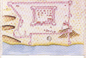
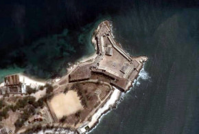
The Turkish raids of 1585 and 1588 were decisive for the Portuguese to decide on the construction of the fort in Mombasa. On 11 April 1593 the fortress was dedicated and named “Fortaleza de Jesus de Mombaça” by Mateus de Mendes de Vasconcelos (he was the captain of the coast, residing at Malindi). The fort was completed in 1596, the plan was a quadrilater with four bastions: S. Felipe, S. Alberto, S. Mathias and S. Mateus. The main gate was near S. Mathias bastion. Above the gate is a Portuguese inscription, which records the dedication to the fort: “Reinando em Portugal Phellipe de Austria o primeiro … por seu mandado ……. fortaleza de nome Jesus de Mombaça a omze dabril de 1593 ….. Visso Rei da Índia Mathias Dalboquerque ……. Matheus Mendes de Vasconcellos que pasou com armada e este porto ……. arquitecto mor da Índia João Bautista Cairato servindo de mestre das obras Gaspar Rodrigues.”
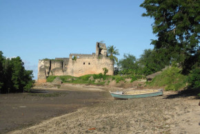
Fort Jesus, located on the edge of a coral ridge overlooking the entrance to the Old Port of Mombasa, was built by the Portuguese in 1593-1596 to protect their trade route to India and their interests in East Africa. It was designed by the Italian architect Giovanni Battista Cairati*. Mombasa became Portugal’s main trading centre along the East Coast of Africa.
The relation between the Portuguese and the Sultan of Mombasa began to deteriorate after the departure of the first captain Mateus de Mendes de Vasconcelos. In 1626 Muhammad Yusif, who had received education in Goa and who was baptized as Dom Jerónimo Chingulia, was made Sultan. On 16 August 1631 the Sultan Dom Jerónimo Chingulia entered the fort and took the Portuguese by surprise. He killed the Portuguese captain Pedro Leitão de Gamboa and massacred the whole Portuguese population of Mombasa (45 men, 35 women and 70 children). A Portuguese expedition was sent from Goa to retake the fort, but after two months of siege (10 January 1632-19 March 1632) they abandoned the enterprise. On 16 May the Sultan abandoned Mombasa and became a pirate. On 5 August 1632 a small Portuguese force under the captain Pedro Rodrigues Botelho, who had remained in Zanzibar, reoccupied the fort.
In February 1661 the Sultan of Oman sacked the Portuguese town of Mombasa, but did not attack the fort. It was in 1696 that a large Omani Arab expedition reached Mombasa. From 13 March 1696 the fort was under siege, the fort having a garrison of 50-70 Portuguese soldiers and several hundred loyal Coast Arabs. The fort was relieved in December 1696 by a Portuguese expedition, but in the following months a plague killed all the Portuguese of the garrison and by 16 June 1697 the defence of the fort was in the hands of Sheikh Daud of Faza with 17 members of his family: 8 African men and 50 African women.
On 15 September 1697 a Portuguese ship arrived with some reinforcement and also at the end of December 1697 another ship came from Goa with a few soldiers. After another year of siege the Portuguese garrison was reduced to the Captain, 9 men and a priest (Fr. Manoes de Jesus) in December 1698.
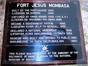
This is the plaque presented by the Omani embassy in Kenya to the National Museum of Kenya with some historical dates of Fort Jesus. Author and Copyright Dietrich Köster.
After a siege of two years and nine months the Omani Arabs took the fort. They could do this, because the garrison was reduced to nine soldiers, the others having died by disease. On the morning of 13 December 1698 the Omani Arabs did the decisive attack and took the fort. Just seven days later a Portuguese relief fleet arrived in Mombasa, but it was too late. With the conquest of Fort Jesus the whole coast of Kenya and Tanzania with Zanzibar and Pemba fell into the hands of the Omani Arabs.
The Portuguese retook the fort in 1728, because the African soldiers in the fort mutinied against the Omanis. The Sultan of Pate, to whom the fort was offered, handed the fort over to the Portuguese on 16 March 1728. In April 1729 the Mombasans revolted against the Portuguese and put under siege the garrison, who was forced to surrender on 26 November 1729.
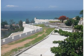
The Fort is today known as one of the best examples of 16th century Portuguese military architecture. In 2011, Fort Jesus was declared a World Heritage Site by UNESCO.
*Giovanni Battista Cairati, born in Milan, was a leading military architect in the the service of King Philip II of Spain, who was also King of Portugal. He worked in Malacca, Mannar, Ormuz, Muscat, Damão, Bassein and Mombasa. He probably never saw Fort Jesus completed, because he died in Goa in 1596.
FORT JESUS TIMELINE
Mombasa: Fortaleza de Jesus (1593), Forte de São Joseph, Fortim da Ponta Restinga, Forte do Sorgidouro, Fortes da Macupa (three forts).
Portuguese: 11 Apr. 1593 Fortaleza de Jesus – 15 Aug. 1631
Sultan of Mombasa: 15/16 Aug. 1631 – 16 May 1632
Abandoned: 16 May 1632 – 5 Aug. 1632
Portuguese: 5 Aug 1632 – 13 Dec. 1698
Oman: 13 Dec. 1698 – Mar. 1728
Portuguese: 16 Mar. 1728 – 26 Nov. 1729
Oman: Nov. 1729 – 1741
Governor of Mombasa: 1741 – 1747
Oman: 1747
Governor of Mombasa: 1747 – 1828 (English protection 1824-1826)
Oman: 1828
Governor of Mombasa: 1828 – 1837
Oman: 1837 – 1856
Zanzibar: 1856 – 1895
English: 1895 – 1963
- This is the plaque presented by the Omani embassy in Kenya to the National Museum of Kenya with some historical dates of Fort Jesus. Author and Copyright Dietrich Köster.
- This gun was salvaged from the German warship Königsberg in World War I and later seized by British forces. It is located next to the entrance gate of Fort Jesus. Author and Copyright Dietrich Köster
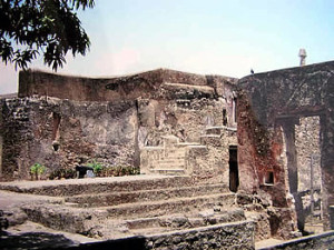
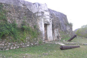
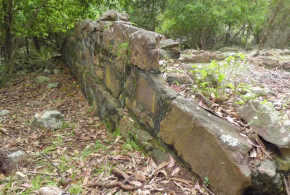
- Some old walls inside Fort Jesus, Mombasa. Author and Copyright Dietrich Köster
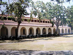
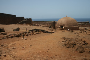
- Cannons and buildings inside Fort Jesus, Mombasa. Author and Copyright Dietrich Köster..
The Portuguese built several small forts around Fort Jesus in Mombasa for a better defence of the island. So many documentation exists on Fort Jesus, but about the others nearly nothing. There is also a confusion about the names.
The following list is the result of the research work done by Hans-Martin Sommer, M.A. Marine Archaeologist of the Fort Jesus Museum, Mombasa.
Information and photos by Hans-Martin Sommer (M.A. Marine Archaeologist of the Fort Jesus Museum, Mombasa).
LIST OF PORTUGUESE FORTIFICATIONS IN MOMBASA:
FORT JESUS: the main Portuguese Fortress.
MAKUPA FORTS (Pos: 04 02′ 12,7″ S 39 39′ 09,7″ E): a small fort (15×15 m) and two towers at each side in a distance of about 100 metres.
“Os tres fortes da Macupa sao tres cazas, que estao feitas em quadro, ao longo do rio, na ilha de Mombaça, pera a banda da terra firme, em hum paço seco, os quaes se fizerao pera tolher a passajem aos Muzungulos da tierra firme pera a ilha. O de meyo he mayor, e nao tem mais que hua caza de sobrado com hua logea em baixo, a que se entra e sobe pella mesma logea (que tera sinco braças de vao tanto de largo como de comprido) cuberta por sima de terrado, onde asistem quinze soldados e hum bombardeiro portugues. Aos soldados se paga dezacete larins cada mes de mantimentos e ao capitao cento e sincoenta xerafins de ordinaria cada anno, o qual capitao o he tambem dos outros dois fortes que lhe fica cada hum de sua ilharga, distancia de hum tiro de espingarda pera cada parte, os quaes tamben sao cada hum hua caza de sobrado cuberta de terrado, mais pequena que o de meyo, que terao tres braças do vao. E asistem sinco soldados em cada hua, que pelejao com seus mosquetes por seteiras que estao feitas a rroda.” Antonio Bocarro “O Livro das Plantas de Todas as Fortalezas, Cidades e Povoaçoes do Estado da India Oriental”
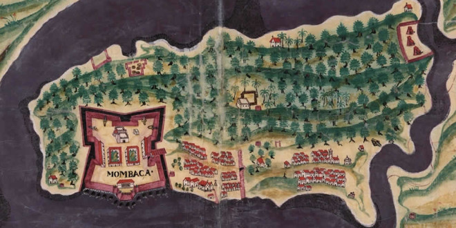
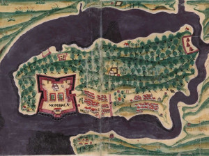
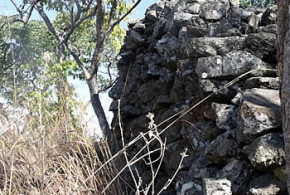
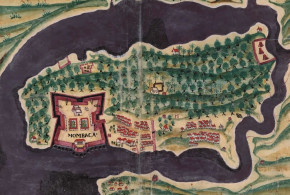
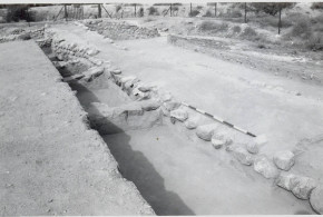
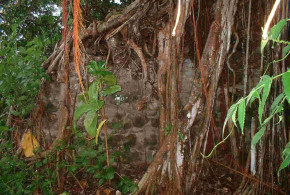
Actual situation: This site was destroyed between 1900 and 1920. Rediscovered on July 2006, were found small wall remains in the ground. At the Eastside of the complex (distance to the fort about 120 m) were found the remains of a “wall, made from sundried bricks”. The east-tower was inside the complex. The other one is probably complete destroyed by the road and railway which leads in a distance of 120 m from the fort. The “Fortes de Macupa” were one fort with towers on each side. In Rezendes map of 1635 you can see the buildings of Makupa in nearly real shape.
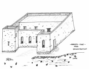
Recostruction of Makupa Fort. A sketch by Hans-Martin Sommer after the first excavation and additional description of a german explorer in 1865. Exist an old photo from about 1900 which shows the ruins as very similar to the recostruction sketch.
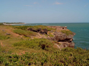
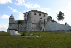
ST. JOSEPH FORT (Pos: 04 04′ 18,1″ S 39 40′ 56.1″ E): a horseshoelike fortification in good condition. At about 100 metres distance to St. Joseph it was the Portuguese chapel “Nossa Senhora das Merces” (Pos: 04 04′ 21,2″ S 39 40′ 50,7″ E).
At about 100 metres distance to St. Joseph there used to be the Portuguese chapel “Nossa Senhora das Mercês” (Pos: 04 04′ 21,2″ S 39 40′ 50,7″ E).
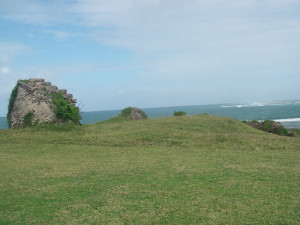
GOLF COURSE FORT (Pos: 04 04′ 20,8″ S 39 39′ 07,5″ E): a few remains near the Golf Course.
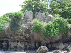
HORSE SHOE FORT (Pos: 04 04′ 43,8″ S 39 40′ 20,2″ E): a very small fortification in good condition. Horseshoe Fort is a small bastion in good condition, no much infos available about its history
FORT OF THE ANCHORAGE (Pos: 04 04′ 33,06″ S 39 39′ 52,33″ E): also called ‘the round fort’ or ‘the hexagonal fort”, completly gone.
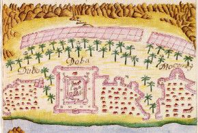
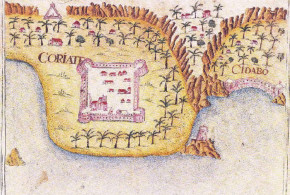
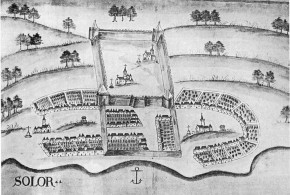
- Map of the Mombasa Fortress, Kenya. Bocarro, António. Livro das Plantas de todas as fortalezas, cidades e povoaçoens do Estado da Índia Oriental. 1635
- Recostruction of Makupa Fort. Sketch by Hans-Martin Sommer
- Remains of the fortification on the Golf Course. This bastion is also called ‘KABERAS’ after a Turkish ship which hit a reef nearby and bombarded the fort. Author and Copyright Hans-Martin Sommer
- A view of the Fort St. Joseph from a nearby tower. In the foreground was the site of the Portuguese Chapel ‘Nossa Senhora das Mercês’. Author and Copyright Hans-Martin Sommer
- Horseshoe Fort, Mombasa, Kenya. Author and Copyright Hans-Martin Sommer
BIBLIOGRAPHY:
– Hinawi Mbarak Ali “Al Akida and Fort Jesus, Mombasa” 85 pp. East African Literature Bureau, 1950, Nairobi, Kenya.
– Boxer,Ch.R. – de Azevedo,C. “A fortaleza de Jesus e os Portugueses em Mombaça 1593-1729” 127 pp. 6 maps, Centro de Estudos Historicos Ultramarino, 1960 Lisboa, Portugal. History of Mombasa under the Portuguese, description of Fort of Jesus.
– Freeman-Grenville, G. S. P. “The Portuguese on the Swahili Coast: buildings and language” In STUDIA N° 49, pp. 235-253, 1989, Lisbon, Portugal.
– Kirkman,J. “Fort Jesus: a Portuguese fortress on the East African coast” 327 pp. 38 maps, Oxford University Press, 1974 London, United Kingdom. Detailed description of Fort Jesus by an archeological point of view.
– Nelson, W.A. “Fort Jesus of Mombasa” 84 pp. Canongate Press, 1994, Edinburgh, UK
– Pearson,M.N. “Port cities and intruders: the Swahili Coast, India and Portugal in the Early Modern Era” 202 pp. 2 maps, The Johns Hopkins University Press, 1998, Baltimore and London. Index: The Swahili coast and the Afrasian sea; the Swahili coast and the interior; East Africa in the world-economy; the Portuguese on the coast.
Written by Marco Ramerini. English text revision by Dietrich Köster.
 Colonial Voyage The website dedicated to the Colonial History
