Written by Marco Ramerini. English text revision by Dietrich Köster.
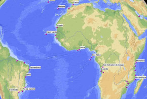
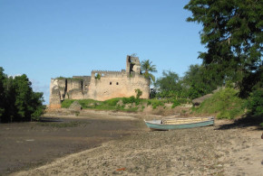
MOZAMBIQUE:
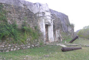
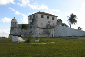
Sofala: (20°10’S – 34°44’E) Forte São Caetano a square-shaped fortress with four bastions.
Portuguese: 21 Sep. 1505 fort – 1974
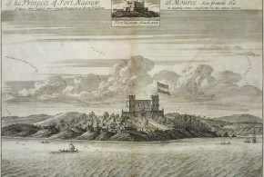
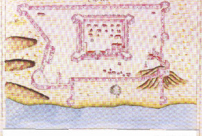
Moçambique: (15°02’S – 40°44’E) Fortaleza de São Gabriel or Fortaleza Velha (1507), Fortaleza or Castelo de São Sebastião (1558), Forte Santo António , Forte São Lourenço (Ilha de São Lourenço)
Portuguese: 1507- 1974
Quelimane: (17°53’S – 36°53’E)
Portuguese: 1530s. ? or 1680s ? – 1974
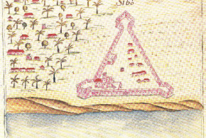
Sena (Vila de Sena): (17°27’S – 35°02’E) Forte São Marçal
Portuguese: 1530s. – 1974
Maria E. Madeira Santos “Viagens de exploração terrestre dos portugueses em África” Pearson “Port cities and intruders” Danvers “Portuguese in India”
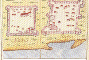
Tete: (16°10’S – 33°35’E) Forte Santiago Major de Tete
Portuguese: 1530s. – 1974
Maria E. Madeira Santos “Viagens de exploração terrestre dos portugueses em África” Pearson “Port cities and intruders”
Chicova: (15°47’S – 32°25’E) Forte São Miguel
Portuguese: 1575 fort – ?
Portuguese: 1614 Forte São Miguel – ?
Maria E. Madeira Santos “Viagens de exploração terrestre dos portugueses em África”
Zumbo: (15°37’S – 30°27’E)
Portuguese: 1690s./1700s. fort – 1974
Ilhas Quirimba:
Portuguese:
Ilha dos Portugueses: (25°58’S – 32°55’E) (off Inhaca island)
Portuguese: ? fortified feitoria – ?
Inhambane: (23°52’S – 35°23’E)
Portuguese: fort 1731 ? – 1974
Welch “Portuguese and Dutch in South Africa”
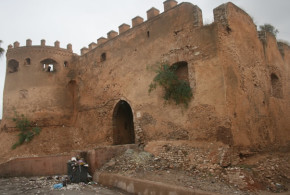
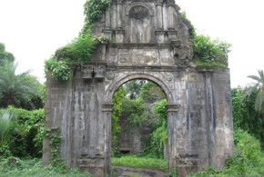
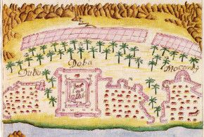
Ibo: (12°20’S – 40°35’E) Forte São João Baptista, Forte Santo António, Forte São José
Portuguese: 1791- 1974
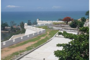
Maputo (Lourenço Marques): (28°58’S – 32°34’E) Fortaleza de Nossa Senhora da Conceiçao
Portuguese: 1799 – 1974 Other settlements were in:
Luabo:
Portuguese: settlement
Gombo:
Portuguese: settlement
ZIMBABWE/MOZAMBIQUE/MALAWI:
In 17 th. c. besides Sena and Tete, the chief outpost were in the direction of the Mazoe valley: at Matuca, Champanbura, Vumba, Dambarere, Massaluna or Matafuna, Chipriviri, Luanze, Fura, Ongwe, Kitamburvisi, Bocuto, Massapa, Manica, and the Zimbawe itself. In each of these places there was a chapel, at least one priest, an annual fair and a fort; if only a field fortress. At the end of the 17th century the Portuguese were expelled from this region.
Welch “Portuguese and Dutch in South Africa” Maria E. Madeira Santos “Viagens de exploração terrestre dos portugueses em África” Pearson “Port cities and intruders”
Butua region: in 1644 several forts were built in this region, a few years later these forts were abandoned.
Maria E. Madeira Santos “Viagens de exploração terrestre dos portugueses em África”
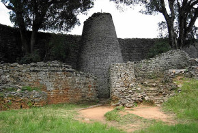
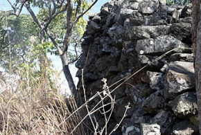
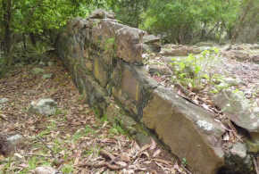
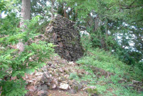
Massi Kessi, Zimbabwe: Massi Kessi is a city is east Zimbabwe, near the Moçambique border. Between 1559 and 1575 Francisco Barreto, portuguese, invaded the region. In that time, portuguese established themselves in Massi Kessi. In the 1630s , is described as having a earth with a dominican church inside of it. In 1684, the city was lost to the Rozvi people. Its name was, at the time, Masekesa, Masekese, or even Chipangura. In 1720, the portuguese founded their settlement once again in Massi Kessi. Together with the Chicanga people, they explored gold mines and traded ivory, gemstones, iron, livestock and copper. It fell in decline in the 1790s, because of Chicanga succession war and the arrival of Nguni refugees from Zululand. Atacked in 1835 by Nxaba, Nguni’s chief, Massi Kessi was abandoned by the portuguese in the same year. But the portuguese returned in the 1880’s, headed by Joaquim Carlos Paiva de Andrada. During their short third presence, the portuguese built a fort in the hills near the city. They had problems with english army (5/11/1890 and 11/5/1891) and abandoned the city in those years (1890/1891).
Written by Zé Miguel Lopes
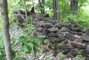
Nhyanga, Zimbabwe: Nhyanga is a city in east Zimbabwe, near the Moçambique border. A few quilometres west of the local police camp, there is, following Dr. Puzey, a portuguese fort. It has a squared entrance and it reminds of Tete or Sena forts.
Written by Zé Miguel Lopes
Chiromo, Malawi: Chiromo is a town in Malawi, near the Moçambique border. It was occupied by the portuguese in 1889. On 12th March 1890, the town was abandonned by the Portuguese.
Written by Zé Miguel Lopes
Chitomborwizi, Zimbabwe: Quitambororozi (or Quitamborvize) was the portuguesese name to the town of Chitomborwizi, near Murombedzi. The portuguese established themselves there probably in 1575. They lost the control of the place in 1597, after an attack by Kapampho, Nsenga’s chief. In the 17th Century, they established themselves again in Chitomborwizi.
Written by Zé Miguel Lopes
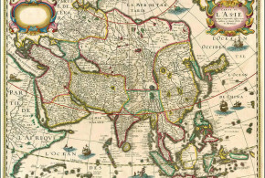
MADAGASCAR:
Santa Luzia (Sainte Lucie): (24°58’S – 47°03’E) (near the mouth of Vinanibe River)
Portuguese: At the beginning of the 16th century (1500s – 1535 ?) (settlement and fort built by Portuguese shipwrecked sailors)
Leitão U. “Os dois descobrimentos da Ilha de Sao Lourenço…..”
TANZANIA:
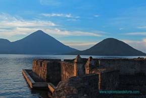
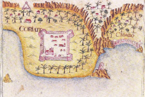
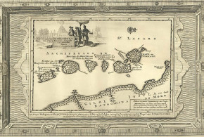
Quiloa or Quíloa (Kilwa Kisiwani): (08°58’S – 39°31’E) Fortaleza de Santiago
Portuguese: 25 Jul. 1505 Fort Santiago – 1512/13 abandoned
Portuguese: feitoria
Boxer – Azevedo “Os Portugueses em Mombaça” Pearson “Port cities and intruders”
Zanzibar: (06°10’S – 39°12’E)
Portuguese: fortified feitoria (fort ?)
Boxer – Azevedo “Os Portugueses em Mombaça” Pearson “Port cities and intruders”
Pemba island: (05°11’S – 39°55’E)
Portuguese: feitoria
Boxer – Azevedo “Os Portugueses em Mombaça”
Mafia island: (07°54’S – 39°41’E)
Portuguese: feitoria (small fort) “… nesta ilha (Monfia)…. o Capitão de Mombaça tem nella seu feitor e hum forte pequeno a borda da aguoa da banda de loeste onde, estando de guerra, asistem dez ou doze soldados portuguezes, que vão de Mombaça, con que se sustenta esta juridição que Sua Magestade tem nella. O dito forte nao he mais que hua caza sobradada de pedra e cal, sem outras armas mais que espingardas que levao os soldados, que pera a gente de terra são bastante.” Bocarro “O Livro das Plantas de todas as Fortalezas … ” vol II, pp. 39-40
KENYA:
Malinde (Malindi): (03°13’S – 40°07’E)
Portuguese: 1498 ally of Portugal, 1502 feitoria – ?
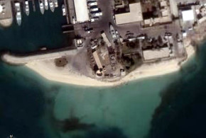
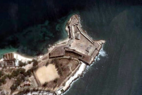
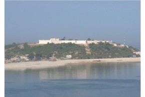
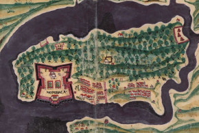
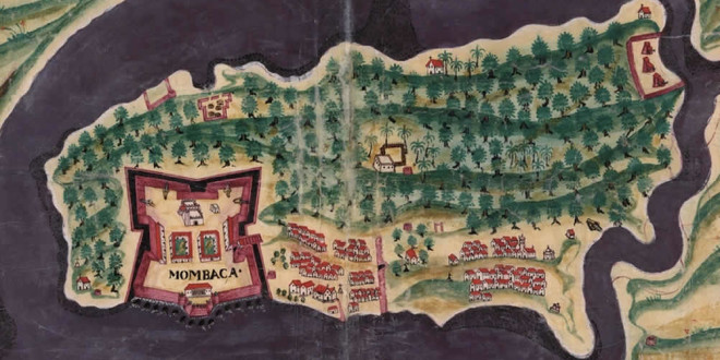
Mombasa: (04°03’S – 39°40’E) Fortaleza de Jesus (1593), Forte de São José, Fortim da Ponta Restinga, Forte do Sorgidouro, Fortes da Macupa (three forts)
Portuguese: 11 Apr. 1593 Fortaleza de Jesus – 15 Aug. 1631
to natives (15/16 Aug. 1631 – 5 Aug. 1632)
Portuguese: 5 Aug 1632- 13 Dec. 1698
to Oman (13 Dec. 1698 – Mar. 1728)
Portuguese: 16 Mar. 1728- 26 Nov. 1729
to Oman (Nov. 1729 – ?)
Boxer – Azevedo “Os Portugueses em Mombaça” Kirkman “Fort Jesus”
Faza: (02°03’S – 41°07’E)
Portuguese: fortified feitoria
Pate: (02°08’S – 41°00’E)
Portuguese: fortified feitoria
Portuguese: alfândega (customs house) 1633-1645
Boxer – Azevedo “Os Portugueses em Mombaça” Pearson “Port cities and intruders”
Lamu: (02°17’S – 40°57’E)
Portuguese: feitoria
Boxer – Azevedo “Os Portugueses em Mombaça”