Written by Marco Ramerini
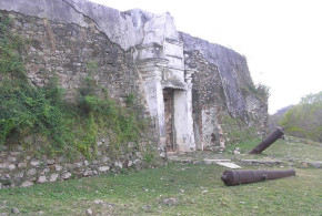
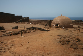
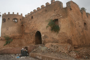
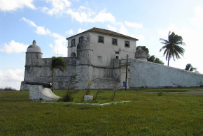
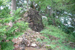
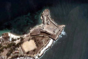
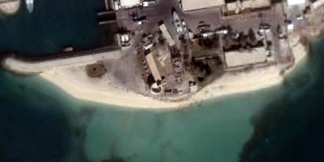
The fort of Halat Bu Maher (also know as Qal’at Abu Mahir) is located on Muharraq island – the northernmost island of the archipelago – and was strategically situated to control both the straits between Bahrain and Muharraq, and the bay between Muharraq Town and Arad Fort.
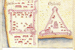
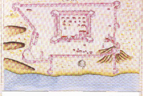
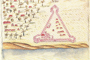
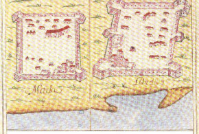
In 1630s. the Portuguese maps (“Livro das Plantas de todas as fortalezas, cidades e povoaçoens do Estado da Índia Oriental” da Biblioteca Pública e Arquivo Distrital de Évora de António Bocarro e Pedro Barreto de Resende) show a tower in the place where now is Fort of Halat Bu Maher (also know as Qal’at Abu Mahir).
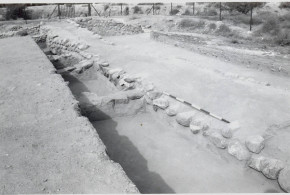
Excavations in the fort were performed in 2010 by the Oxford Brookes Archaeology, whose results were published in 2011. These investigations have not led to the discovery of any architectural or artefactual remains could be associated with the Portuguese occupation. However, it is possible that the foundations remains of the Portuguese tower can be hidden within the large southwestern tower of the 19th century fort. The current fort dates back to the 19th century.
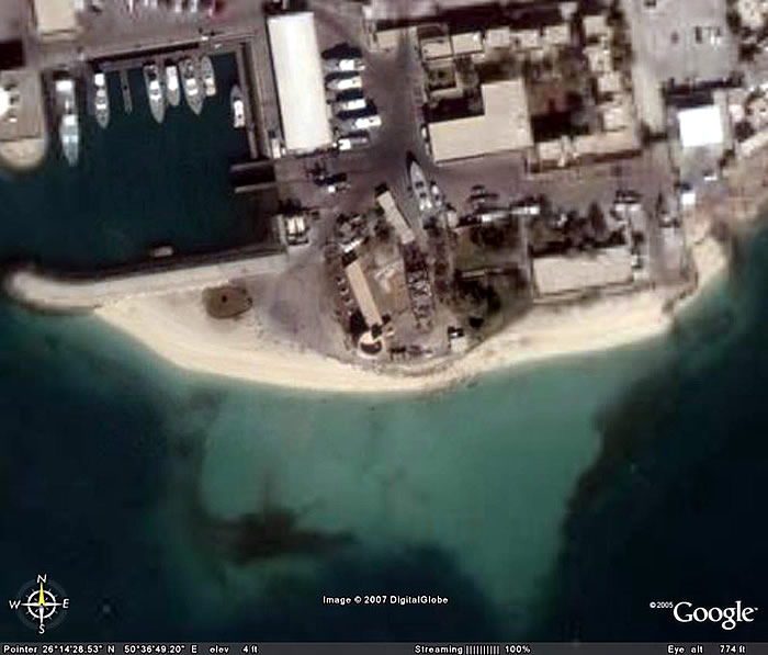
Fort of Halat Bu Maher, Bahrain
BIBLIOGRAPHY:
– Carter, Robert “Bu Maher Fort, Muharraq. Report on Excavations in 2010 for the Ministry of Culture and Information, Bahrain. Investigations of a 19th century fort in Muharraq, Bahrain, with earlier elements” Robert Carter, Mike Morley and Chaz Morsewith contributions by Tony Grey and Tim Murphy Oxford Brookes Archaeology and Heritage August 2011 Bu Maher Fort, Muharraq. Report on Excavations in 2010 for the Ministry of Culture and Information, Bahrain. Investigations of a 19th century fort in Muharraq, Bahrain, with earlier elements